Find Errors Puzzle #1
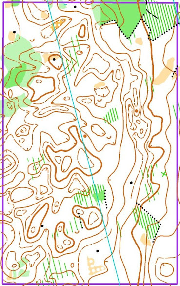
In the first edition of this new series, I invite you to find six errors in the depiction of the relief on this map.
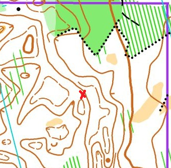
See below for a map showing the locations of the bugs, followed by detailed explanations for each one.
Every fifth contour shall be drawn with a thicker line. This is an aid to the quick assessment of height difference and the overall shape of the terrain surface.
2. There should be four regular contours between two neighboring index contours of different levels. Therefore, there cannot be a depression here. This index contour shows a hill.
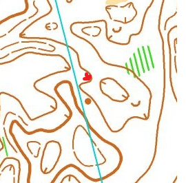
4. Judging by the surrounding forms, a hill rather than a depression would be more appropriate here. Although, purely theoretically, a depression is also possible. However, in this case, we have incorrectly mapped the form lines.
5. On this contour, one slope line is facing the wrong way. This contour indicates a slope with a downhill to the east. To the west of this contour, there is a large, complex-shaped depression (highlighted in red). There is a small, narrow ridge between the depression and the slope (shown in blue).
The original map looks like this (the map is from the New ‘Confident Orienteering’ Book 2, planned for release in December 20204).
Until book 2, "Routes: Planning and Execution," comes out, I recommend reading Book 1 on the basics of the navigational approach to minimise errors.
Aleksandr Alekseyonok, June 8, 2024


Comments
Post a Comment